Saturday, 27 April 2024
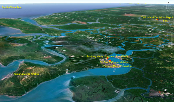
Strategic Location
Tanjung Manis Integrated Port Sdn.Bhd is located at latitude 2 ˚ 08’N longitude 111˚21’E at right side of Tanjung Sebubal along the upper north bank of the Rajang river. It situates only 30 km from the mouth of the Rajang river with draught of 11 metres, thus providing a safe berthing place for large ocean-going vessel.
Its strategic location, landforms and natural deep-water anchorage make TMP a vital hub for feeders and other mode of water carriers utilizing the Rajang waterways and also to attract mainline vessels to call at the proposed new container terminal at Selumit in the near future.
View From Google Earth